Javascript is required

Value added services for data acquisition

The Luhai Kongjian strives to explore the market for remote sensing image data processing applications, provide high-quality remote sensing data services that integrate space, space, and land, and strive to become an international first-class comprehensive remote sensing data application service provider, providing value-added services based on domestic and foreign multi-source remote sensing images.

图片
Value added services for data acquisition

The Luhai Kongjian strives to explore the market for remote sensing image data processing applications, provide high-quality remote sensing data services that integrate space, space, and land, and strive to become an international first-class comprehensive remote sensing data application service provider, providing value-added services based on domestic and foreign multi-source remote sensing images.

Aerospace DataService

The Luhai Kongjian can provide high-quality value-added services based on SAR, optical, and laser data, including 4D product production, multi-source data processing, image interpretation and analysis, and high-precision image production.

Service content:

Provide digital elevation model (DEM), digital orthophoto map (DOM), digital raster map (DRG), and digital line drawing (DLG) for production;

Provide satellite image orthorectified correction, image fusion, and image mosaic services;

Provide services such as image interpretation, target recognition, and tracking;

Provide data analysis, change monitoring and other services;

Provide various thematic map production services.

logo
logo
Aerospace DataService

The Luhai Kongjian can provide efficient unmanned aerial vehicle data services for geological exploration, disaster monitoring, land resources and management, environmental monitoring and other needs.

Service content:

Provide 1:500, 1:1000, and 1:2000 orthophoto images;

Provide 3D models with resolutions of 1.5cm, 3cm, and 5cm;

Provide high-precision digital elevation models;

Provide multispectral unmanned aerial vehicle data processing and analysis services;

Provide drone thematic mapping services.

Ground DataService

The Luhai Kongjian can provide ground photogrammetric data acquisition services, mainly including ground calibration field, mobile measurement, static measurement and other data provision and application.

Service content:

Provide ground calibration field design services with 1:1000 and 1:2000 scale digital orthophoto images and digital elevation model reference data;

Provide ground calibration field design services;

Provide intelligent driving maps based on mobile measurement, urban visualization display, and real-time map data services;

Provide high-precision data collection and analysis services based on static measurements.

logo
logo
Big Data Analysis Services

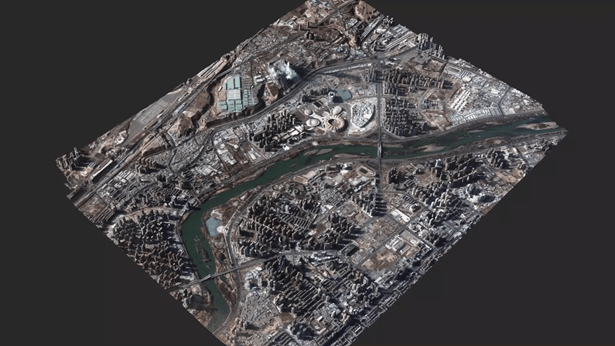
Remote sensing big data is an inevitable trend that conforms to the development of the big data era, and it is the realization of the value of big data in the field of remote sensing. The Luhai Kongjian remote sensing technology has been extensively researched, focusing on high-resolution remote sensing, unmanned aerial vehicle remote sensing, ocean big data platforms, agricultural remote sensing big data platforms, hydrological and meteorological geological disaster big data platforms, smart cities, etc. It can provide high-quality big data analysis services based on massive data

Service content:

Based on high-resolution remote sensing data, analyze the spatiotemporal changes of land use cover, such as buildings, vegetation, water bodies, etc;

Analyzing GDP, population density, water and electricity consumption, and thematic maps of global poverty-stricken areas based on night light remote sensing data;

Monitoring crop growth and yield evaluation using hyperspectral remote sensing data;

Massive data for disaster prediction and prediction in hydrology, meteorology, and geology;

The geographic location information obtained through oblique photography, street view technology, and other means is the foundation for the integration and sharing of spatiotemporal big data. It can provide four-dimensional integrated data support for various industries such as smart cities, land, planning, economy, surveying and mapping, disaster emergency response, tourism, water conservancy, agriculture, and cultural relic protection.

15801018805

Satellite Data Industrial Park, Fengcheng Street, Haiyang City, Yantai City, Shandong Province

微信二维码
微博二维码
陆海空间(烟台)信息技术有限公司

Luhai Kongjian(Yantai) Information Technology Limited Company

微信二维码
微博二维码

15801018805

Satellite Data Industrial Park, Fengcheng Street, Haiyang City, Yantai City, Shandong Province