Javascript is required

Agricultural Remote Sensing Monitoring

To serve agricultural production through the means of `Autonomous Satellites + Efficient Processing + Precise Interpretation`. Agricultural remote sensing can continuously observe the ground for a long time, forming an integrated multidimensional information set of time and space. This large-scale, real-time and accurate multidimensional spatiotemporal information plays an irreplaceable role in the development of agricultural production.

图片
Existing Problems

In traditional agriculture, there are six major problems

Delayed information acquisition

Relying on manual interpretation, inaccurate data, and discontinuity in time range

Significant meteorological influence

Environmental factors greatly affect plant growth and result in low returns.

Traditional costs are increasing day by day

High labor costs, long working hours, and low production efficiency.

Soil pollution
Soil pollution

Lack of soil nutrient indicators leads to excessive cultivation, fertilization, and serious soil pollution.

Manual recording by maintenance personnel

Highly dependent on manual operation, inaccurate judgment of environmental detection

Food safety
Food safety

Frequent food safety issues have entered the market, posing a threat to public safety.

The application of satellite remote sensing data in agricultural remote sensing

To serve agricultural production through the means of `Autonomous Satellites + Efficient Processing + Precise Interpretation`. Agricultural remote sensing can continuously observe the ground for a long time, forming an integrated multidimensional information set of time and space. This large-scale, real-time and accurate multidimensional spatiotemporal information plays an irreplaceable role in the development of agricultural production.

Agricultural resource survey

Remote sensing technology can quickly obtain macro information and monitor and evaluate the quantity, quality, and spatial distribution of cultivated land.

Smart agriculture

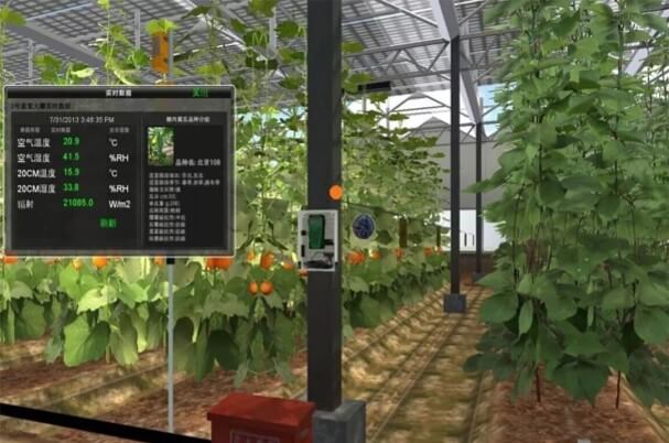
Analyze the monitoring of crop growth through remote sensing, crop yield, and soil nutrient monitoring, as well as agricultural meteorological services and crop supervision.

Agricultural disaster monitoring, drought, floods

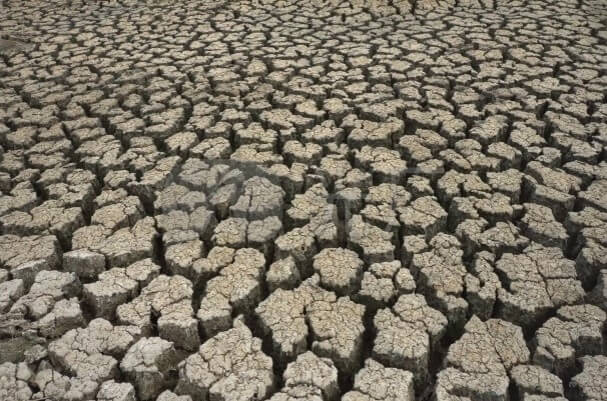
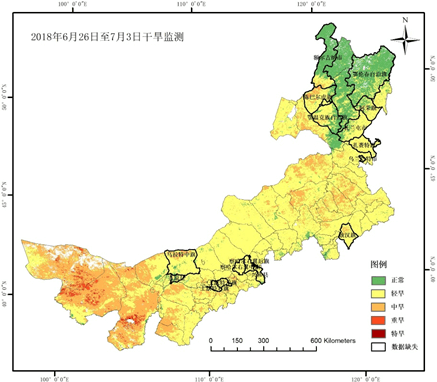
The use of remote sensing technology to monitor drought conditions mainly involves continuous monitoring, evaluating relevant data of designated objects, and regularly publishing drought distribution maps for different regions.

Agricultural resource survey
Farmland monitoring

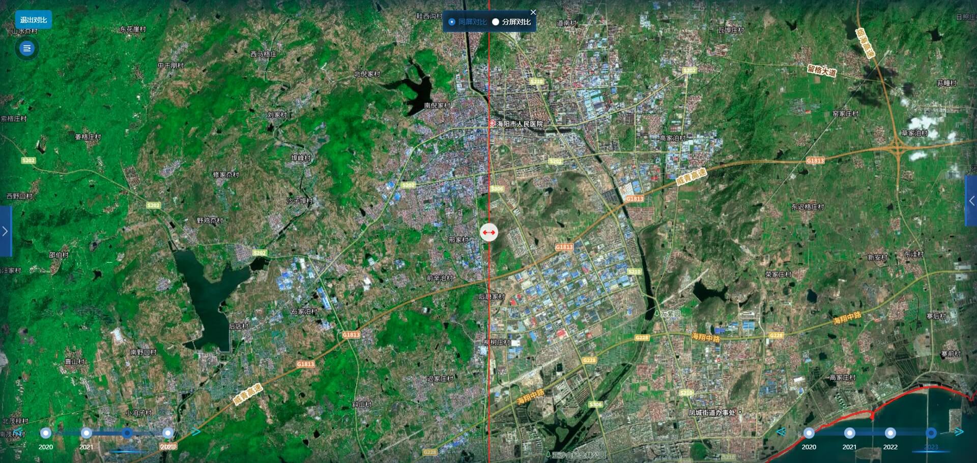
In accordance with the planning requirements of farmland protection red line and permanent basic farmland, timely warning should be given for illegal occupation of farmland for non-agricultural construction, and a normalized monitoring and supervision mechanism should be established for early detection, early prevention, and strict investigation and punishment. Realize fine-grained management of land grid, combine land parcel zoning, build parcel archives, achieve dynamic data updates, and combine maps for visual management. Thus providing scientific basis for the development, utilization and protection of agricultural resources, agricultural planning, agricultural ecological environment protection, and sustainable development of agriculture.

Non grain monitoring

Extract and calculate the non grain conversion areas and changes in high standard farmland, support non grain map warning and data statistical analysis functions, provide data decision-making basis for the implementation of policies such as non grain conversion and industrial subsidies in high standard farmland, and achieve `map management of farmland`.

UI
Smart agriculture
作物长势
Remote sensing monitoring of crop growth

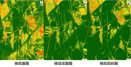
Regular monitoring of grain crop growth using Normalized Vegetation Index (NDVI) technology.

Crop yield monitoring

Establish a crop yield prediction model by analyzing historical farmland yield data, yield data, meteorological data, satellite remote sensing and other data.

Remote sensing monitoring of soil nutrients in farmland

Using high-resolution remote sensing data, mainly utilizing soil spectral characteristics to monitor soil nutrient content.

Agricultural meteorological services

The agricultural meteorological disaster monitoring and prediction system can achieve full tracking and monitoring of the occurrence and development process of meteorological disasters from macro to micro, providing a basis for the prevention and control of agricultural meteorological disasters, and minimizing the agricultural losses caused by agricultural meteorological disasters.

Homework supervision

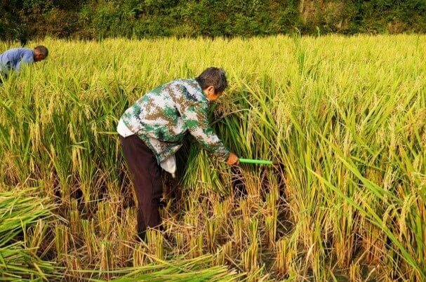
Monitoring data on various types of operations such as cultivation, planting, harvesting, fertilization, medicine, drying, and storage, including area, amount, dosage, and water usage, as well as depth of operation, soil excavation rate, monitoring of repeated operations such as heavy tillage and missed tillage, and collection of photos of operation scenes.

Agricultural disaster monitoring, drought, floods
Monitoring drought conditions

Through continuous monitoring, evaluate relevant data of designated objects, and regularly release drought distribution maps for different regions. The use of remote sensing technology to detect the overall trend of drought is basically in line with the needs of agricultural production, and the released regional information also has a certain degree of accuracy.

Monitoring disaster situation

When floods occur, most of them are cloudy and rainy, and optical images are basically unable to capture effective images. At this point, radar imagery can leverage its advantage of not being affected by weather imagery. There are many radar satellites, such as Gaofen-3, LandTan 1, HaiSi-1 (Chaohu 1), Sentinel-1, etc. Using satellites to monitor the severity of the impact of high-intensity precipitation induced floods on agriculture, quickly and clearly understanding the full picture of floods, and efficiently and accurately grasping the disaster situation.

Remote sensing monitoring of crop diseases

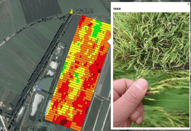
Utilize existing hyperspectral remote sensing image products, ground measurement data, and other data information, with the support of disease monitoring indicators and spatial analysis technology, to carry out remote sensing monitoring of crop diseases. Collect farmland map data through satellites, drones, and IoT monitoring equipment to generate multi-dimensional agricultural monitoring maps of crop growth and pests and diseases.

agricultural insurance

Based on the situation of agricultural insurance, in cooperation with banks, insurance companies, etc., remote sensing methods are used to conduct emergency monitoring and data analysis of the affected area of crops on the basis of land parcel segmentation and crop growth monitoring; Provide precise underwriting services for agricultural insurance and accurate assessment of disaster losses.

agriculture4

15801018805

Satellite Data Industrial Park, Fengcheng Street, Haiyang City, Yantai City, Shandong Province

微信二维码
微博二维码
陆海空间(烟台)信息技术有限公司

Luhai Kongjian(Yantai) Information Technology Limited Company

微信二维码
微博二维码

15801018805

Satellite Data Industrial Park, Fengcheng Street, Haiyang City, Yantai City, Shandong Province