The first batch of images will be unveiled! Spanning thousands of miles, Yantai No.2 takes you to see the world!
February 19th, 2024
Hello everyone, I am `Yantai 2`. On February 3, 2024, I carried the Jielong 3 Yaosan carrier rocket into space and have been in space for 16 days. In these days, I have been constantly transmitting high-definition images and valuable data about the Earth, capturing various telemetry data and in good condition. I have captured the beautiful scenery of the other end of the Earth for everyone, and now I will take you on this magical journey in space. Let's enjoy these stunning panchromatic multispectral fusion images together!
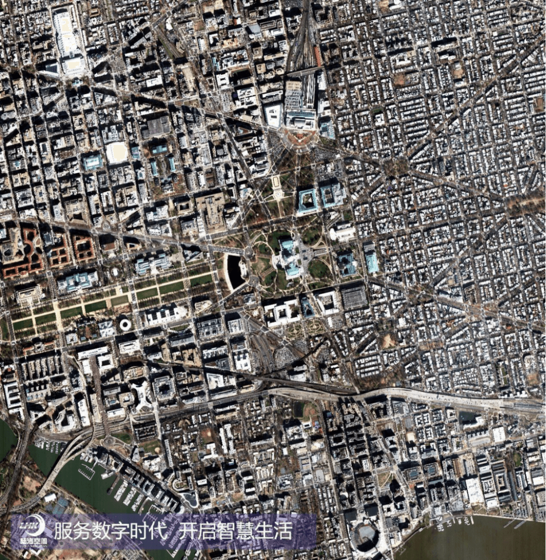
Yantai 2 satellite remote sensing image: downtown Washington, D.C
This important city in the United States has a clear view of high-rise buildings and street layouts.
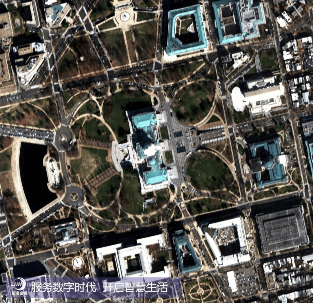
Yantai 2 satellite remote sensing image: United States Capitol Building
This iconic building in the United States presents its nearby streets, parks, and buildings.
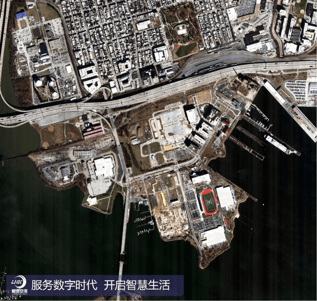
Yantai 2 satellite remote sensing image: Baltimore - Small Port
The view of the harbor is panoramic, with ships shuttling back and forth.
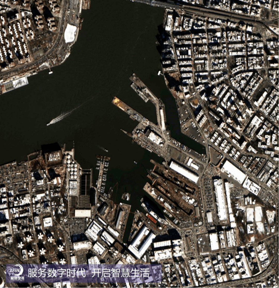
Yantai 2 satellite remote sensing image: New York Williamsburg
The urban planning of New York City is perfectly reflected, and the urban landscape is clearly visible.
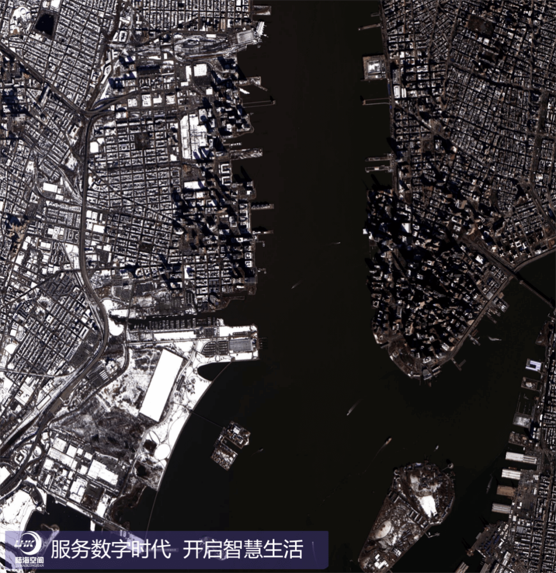
Yantai 2 satellite remote sensing image: Upper Bay, New York New Jersey
The area at the border of the two states presents an urban and natural landscape.
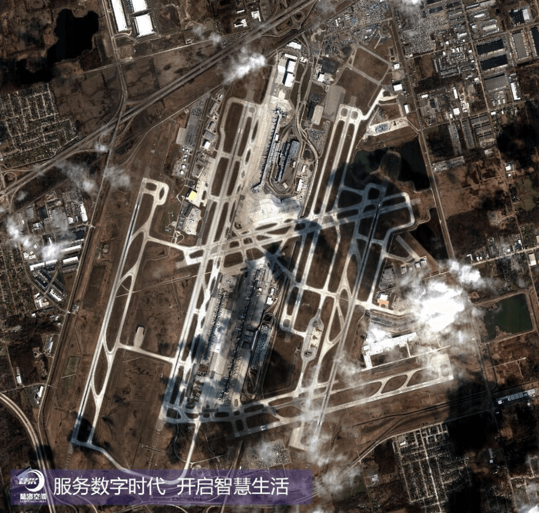
Yantai 2 satellite remote sensing image: Detroit Airport
As an important transportation hub in the United States, it presents a busy and orderly airport.
These images demonstrate my high-resolution imaging ability and allow us to appreciate the beauty of the Earth from different perspectives. Not only has it played an important role in obtaining geographical information domestically, but it has also demonstrated China's aerospace capabilities on the international stage. Please look forward to bringing you more exciting satellite images in the future!
Lu Hai Kong Jian (Yantai) Information Technology Co., Ltd. was jointly initiated by Shandong Provincial Marine Aerospace Equipment Technology Innovation Center and Academician Li Deren and his team from Wuhan University, with Academician Li Deren serving as the Chief Scientist. The company is responsible for the construction and operation of the Oriental Wisdom Eye Constellation. The `Yantai 2` satellite launched this time is also the first business star of the Oriental Wisdom Eye Constellation, committed to providing fast, accurate, and intelligent remote sensing information services directly to intelligent terminals for professional and public users.