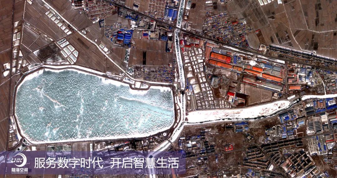
Yantai 2 satellite remote sensing image: East Coast region of Brazil
At 11:06 am Beijing time on February 3, 2024, the `Yantai 2`` satellite, jointly developed by Lu Hai Kong Jian (Yantai) Information Technology Co., Ltd. and the Fifth Academy of Aerospace Science and Technology Group, was successfully launched aboard the Jielong 3 Yaosan carrier rocket, and the satellite entered its designated orbit smoothly. After the satellite was put into orbit, the scheduled flight program was completed, and all telemetry data was normal. The satellite was in good condition.
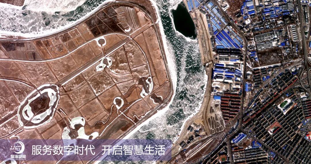
The Yantai 2 satellite was put into orbit for only 10 hours, and the first answer sheet was handed over, successfully transmitting the first clear image in orbit. According to the mission plan, imaging instructions were uploaded at 20:13 on February 3, 2024. The satellite arrived over the eastern coast of Brazil at 20:47 on February 3 and successfully started imaging. The first image was successfully transmitted back at 21:45 on February 3. The image details are clear, the texture is clear, and the colors are distinct, achieving the `Dong Fang Hui Yan` speed of producing images on the same day of launch!! On the morning of February 4th, the satellite continued to image Yingkou and other areas in Liaoning, and the images were clearly transmitted back.
Yantai 2 satellite remote sensing image: Yingkou City, Liaoning Province
The Yantai 2 satellite is a high-resolution intelligent multispectral remote sensing satellite with a resolution of 0.5m, a width of 12km, a maximum data transmission rate of 1.8Gbps, and a total weight of 230kg. It has the characteristics of light weight, high resolution, and excellent imaging quality, and all indicators are at the leading level in the industry. The Yantai 2 satellite is equipped with a fully autonomous in orbit intelligent processing terminal, which can achieve target detection, recognition, and extraction functions in orbit. It can automatically detect and recognize targets such as airplanes, large ships, ports, and popular tourist attractions, and extract information and slice the identified targets. The satellite has uniquely designed a real-time generation function for region of interest (ROI) standard images in orbit, which enables real-time generation and transmission of key images in orbit, effectively improving the speed and efficiency of user acquisition of standard images, and greatly expanding the application fields of in orbit intelligent processing.
Lu Hai Kong Jian (Yantai) Information Technology Co., Ltd. was jointly initiated by Shandong Provincial Marine Aerospace Equipment Technology Innovation Center and Academician Li Deren and his team from Wuhan University, with Academician Li Deren serving as the Chief Scientist. The company is responsible for the construction and operation of the Oriental Wisdom Eye Constellation. The `Yantai 2` satellite launched this time is also the first business star of the Oriental Wisdom Eye Constellation, committed to providing fast, accurate, and intelligent remote sensing information services directly to intelligent terminals for professional and public users.