Go Dongting! 'Dong Fang Hui Yan' hits the dike at Dongting Lake.
July 9th, 2024
Due to the continuous heavy rainfall and increased inflow from upstream, the water level of Dongting Lake has been rising steadily over the past few days. At around 16:00 on July 5th, a piping hazard occurred on the first-line embankment of Tuanzhouyuan in Huarong County, Hunan Province, along the Dongting Lake. At 17:48, after an emergency blockage attempt failed, the embankment breached.
To obtain the on-site situation of the disaster-affected area, Lu Hai Kong Jian arranged emergency reconnaissance based on the passage of Dong Fang Hui Yan 01 (Yantai-2 Satellite) and observed the disaster area in Huarong County, Yueyang City.
At 11:25 on July 7th, the Dong Fang Hui Yan 01 satellite captured high-resolution satellite images of the breach in the dike at Dongting Lake, showing the flooding situation in the area.
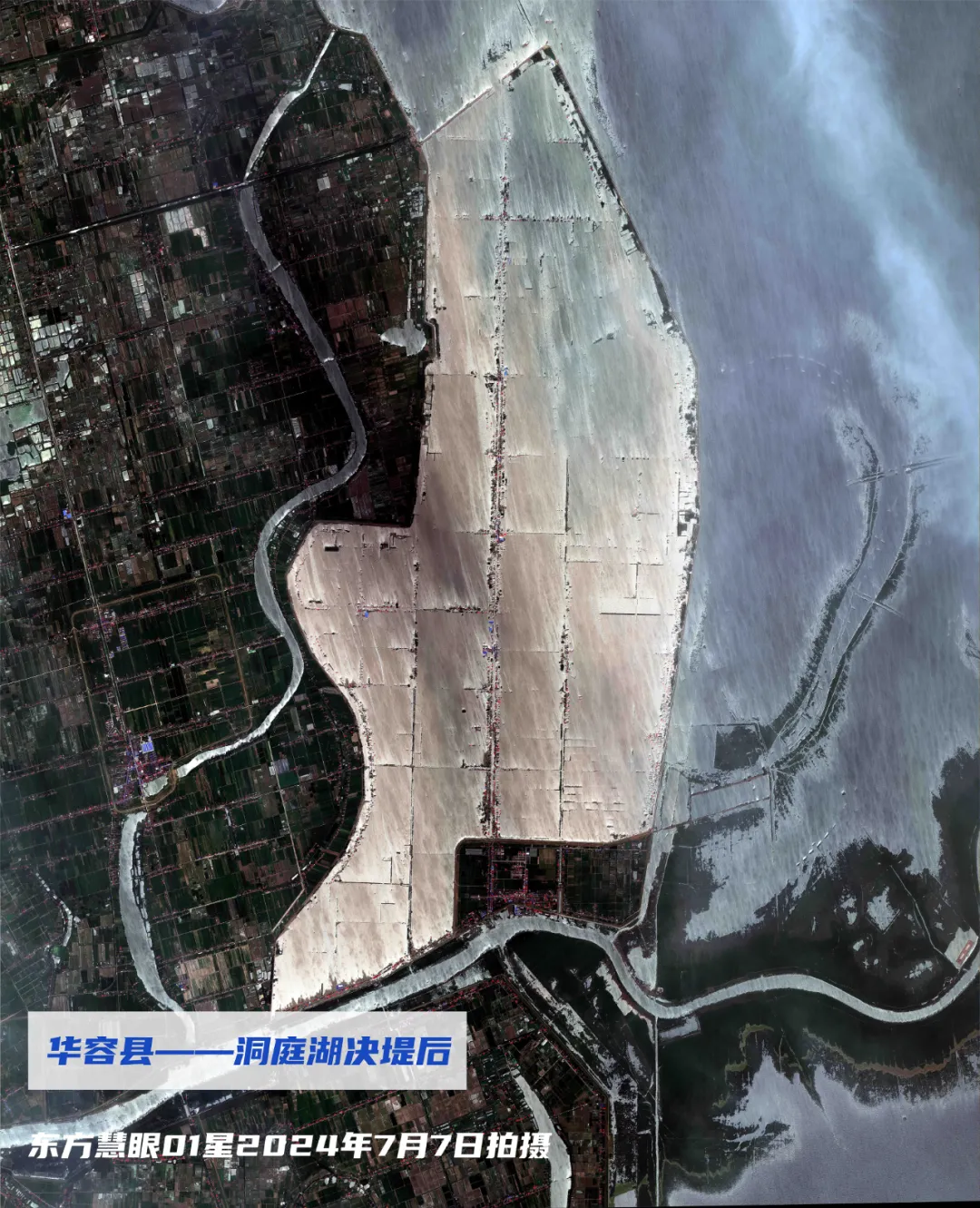
Photographed at 11:25 am on July 7th, with an angle of 22.5°
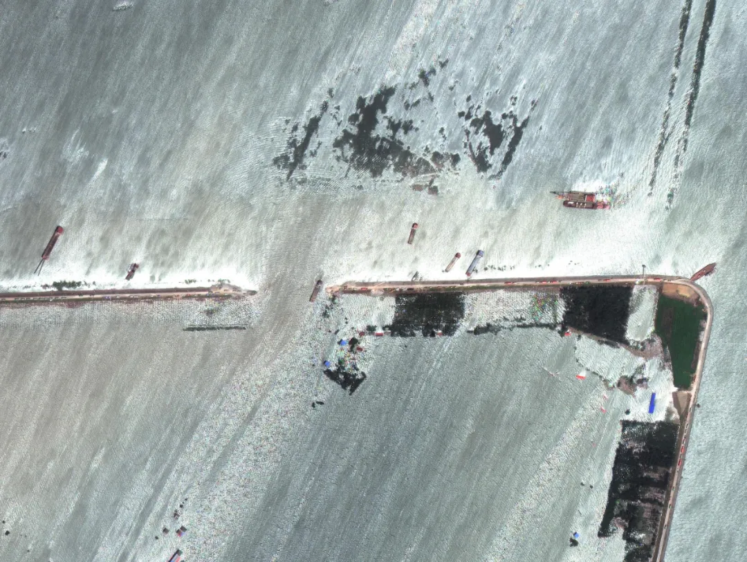
Local area image
Lu Hai Kong Jian's Dong Fang Hui Yan 01 satellite will continue to monitor the disaster area, providing remote sensing satellite data support for flood rescue and disaster assessment efforts.
Translation: Since the spontaneous occurrence of the disaster, the rescue personnel have been fighting day and night, working tirelessly to block the disaster 24 hours a day, racing against time and contending with the flood. The breach is continuously shrinking, and it is expected to be completely sealed off by 12:00 on the 9th.
We are looking forward to the early arrival of the moment when the breach is sealed, allowing the Tuanzhouyuan to regain its former peace. Dongting will win! Go Huarong!